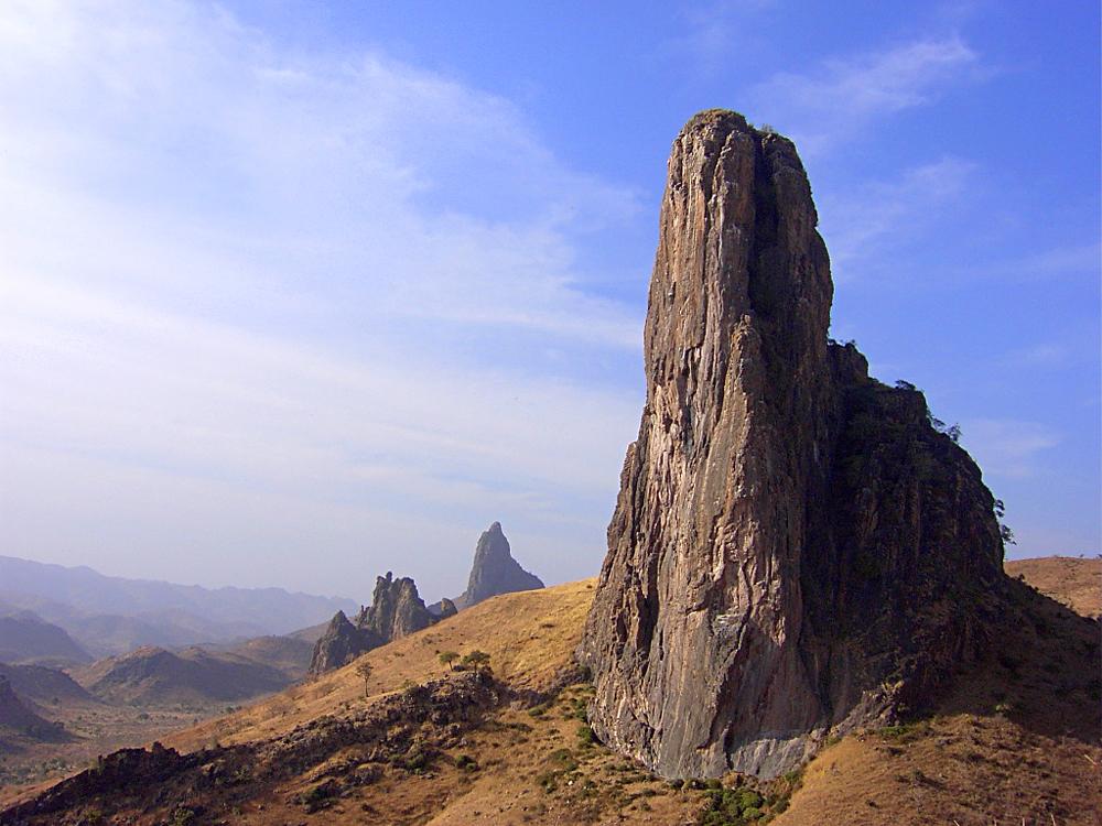
Rhumsiki Peak, Far North — Wikimedia Commons
Hiking in Cameroon, with the information you actually need
Real distances and durations, difficulty ratings that mean something specific, live weather that tells you when not to go, permit rules, and registered local guides you can book directly. Most people who want to hike here never start, because what they could find before was vague, wrong or missing.
- 17
- Checked trails
- 10
- Regions covered
- 4,040 m
- Highest summit
- 4
- Honest difficulty levels

Featured hike
Mount Cameroon — Guinness Route to Fako Summit
West Africa's highest peak and an active volcano: 4,040 m of rainforest, montane grass and black lava, climbed from Buea in two hard days.
- Distance
- 36 km
- Time
- 2 days
- Ascent
- 3,080 m
Trails
More places to hike
Volcanic summits, crater lakes, rainforest and savannah — spread across 5 regions.

North-West
3,011 m
Mount Oku and the Kilum-Ijim Forest
Nearest town: Elak-Oku (Kumbo)
Cameroon's second-highest peak at 3,011 m, ringed by the largest surviving montane forest in West Africa and a crater lake the Oku people hold sacred.
- Distance
- 18 km
- Time
- 9 h
- Ascent
- 960 m

West
2,740 m
Mount Bamboutos Ridge Traverse
Nearest town: Mbouda
A 2,740 m ridge walk across the roof of the Western Highlands, above Mbouda — long, open, cold, and the finest high-country views in Cameroon.
- Distance
- 22 km
- Time
- 10 h
- Ascent
- 1,080 m

Littoral
2,411 m
Manengouba Crater and the Twin Lakes
Nearest town: Bangem / Melong
A grassy caldera rim at 2,411 m above Bangem, holding the male and female lakes — big skies, Fulani cattle herds, and the gentlest high-altitude walking in Cameroon.
- Distance
- 14 km
- Time
- 7 h
- Ascent
- 780 m

South-West
2,064 m
Mount Kupe from Nyasoso
Nearest town: Nyasoso (Tombel)
A steep 2,064 m forest peak above Nyasoso, famous among birdwatchers for the Mount Kupe bushshrike and thick with local legend.
- Distance
- 11 km
- Time
- 8 h
- Ascent
- 1,230 m

North-West
1,920 m
Lake Awing Crater Walk
Nearest town: Awing (Santa)
A half-day highland loop around a quiet volcanic crater lake between Bamenda and Santa, through Fulani grazing land and eucalyptus.
- Distance
- 9.0 km
- Time
- 4 h
- Ascent
- 320 m

Adamawa
1,240 m
Ngaoundaba Crater Lake Loop
Nearest town: Ngaoundéré
Rolling Adamawa plateau walking to a forested crater lake south of Ngaoundéré — cool, green, and almost empty of other hikers.
- Distance
- 11 km
- Time
- 4 h 30
- Ascent
- 290 m
Never hiked before?
Start with one of these
Under four hours, clear paths, and reachable in a day from Douala or Yaoundé. Do these before you book Mount Cameroon.
North-West
1,920 m
Lake Awing Crater Walk
Nearest town: Awing (Santa)
A half-day highland loop around a quiet volcanic crater lake between Bamenda and Santa, through Fulani grazing land and eucalyptus.
- Distance
- 9.0 km
- Time
- 4 h
- Ascent
- 320 m

Centre
1,073 m
Mont Fébé Circuit, Yaoundé
Nearest town: Yaoundé
A forested city hill rising above Yaoundé to 1,073 m — the best short training walk in the capital, doable before work.
- Distance
- 7.0 km
- Time
- 2 h 30
- Ascent
- 350 m

Littoral
Ekom-Nkam Falls Forest Walk
Nearest town: Nkongsamba
A short, wet, dramatic descent through rainforest to an 80 m waterfall on the Nkam river — the easiest big-payoff hike in Cameroon.
- Distance
- 2.8 km
- Time
- 2 h 30
- Ascent
- 210 m
Ratings you can trust
What our difficulty levels mean
These are not vibes. Each level is a specific commitment about time, terrain and consequence, and every trail is rated against it.
Under 4 hours on a clear path. Fine for a first hike.
See easy trails →
Half to full day with real climbing. Needs basic fitness.
See moderate trails →
Long day, sustained steep ground. Build up to it.
See hard trails →
Multi-day, high altitude or big-game country. Consequences if it goes wrong.
See expert trails →
Why this exists
Bad information keeps people off the trail
Every problem below is one we heard from people who wanted to hike in Cameroon and gave up. Each one has a specific answer on this site.
“How long does it actually take?”
Every trail carries a measured distance, ascent and realistic duration for a moderately fit hiker — plus what the difficulty rating commits to.
Browse trails →“Is it safe right now?”
Live conditions on every trail page, read as a plain verdict: good to go, take care, or not advisable. Plus hazards, water, and regional security notes.
Read safety guidance →“Who do I even ask?”
Registered guides with verified profiles, real day rates, languages spoken, and departure dates you can book without a phone call.
Find a guide →Pick a region, then a place
Choose one of Cameroon's ten regions, then a landmark inside it — trip planning stays limited to destinations within the country.
New to this?
What hiking actually is, and what it takes
Hiking is walking a route on foot, usually outside a city, for long enough that it takes real planning rather than a stroll — anywhere from two hours to several days. You don't need to be an athlete. You do need the right expectations going in.
A route, on foot, outdoors
Forest trails, volcanic slopes, savanna tracks or a coastal path — measured in distance and elevation gain, not just time. Easy routes run under 4 hours; summit attempts can run several days.
Ordinary fitness, honestly rated
No special athleticism for an Easy or Moderate trail — a fit non-runner manages fine. Hard and Expert routes need real preparation: build up to them rather than starting there.
The right gear, not lots of it
Boots, water, a rain layer and a charged phone cover most day hikes. Multi-day and summit trips add a sleeping bag, warm layers and food — the full checklist is on the safety page.
Usually with someone who knows the ground
Registered local guides handle route-finding, weather calls and permits — required outright on some trails, strongly advised on the rest. Booking one is built into every trail page.
Before you go
The things that actually go wrong
Mountain rescue does not exist here. On Mount Cameroon, evacuation means your guide and porters carrying you down. That single fact shapes every piece of advice on this site — and it is why we would rather tell you to turn back than sell you a summit.
Read all safety guidelinesTell someone your plan, and give them a turnaround time
Write down your route, your guide's name and phone number, and the time you expect to be back. Leave it with someone who is not on the hike. Above 2,000 m on Mount Cameroon and Mount Oku there is no reliable mobile coverage, so nobody will know you are overdue unless you arranged for them to notice.
Hire a registered local guide
On Mount Cameroon, in Bénoué and in the Dja reserve a guide or ranger is legally required and enforced at the gate. Everywhere else it is still the right call: highland paths braid into dozens of identical cattle tracks, forest paths disappear in a season, and a guide is the difference between a good day and a search party. It also keeps the money in the communities that maintain the trails.
Match the trail to your actual fitness
Difficulty ratings on this site mean something specific. EASY is under 4 hours on a clear path. MODERATE means a half to full day with real climbing. HARD means a long day, sustained steep ground and a level of fitness you have to build. EXPERT means multi-day, high altitude or big-game country, with consequences if it goes wrong. Do Mont Fébé and Ekom-Nkam before you book Mount Cameroon.
Save trails, book guides, share your photos
A free account gets you saved trails, reviews, photo uploads and direct booking. Premium adds downloadable offline packs — route, waypoints, hazards and emergency numbers — for when the signal goes, which on these mountains it will.